
North Coast Trail & Cape Scott Trail - Cape Scott Park, BC July 13 - 20, 2015
(Part 2 - Cape Scott Trail Section)
The Cape Scott Park trails are much wider, less rooty, and generally much easier to hike on than the North Coast trail sections. These last two and a half days would not necessarily be easier though. Although you are not looking at your feet constantly, we had much longer (in kilometers but not really time) to hike each day. The hiking was also mentally draining in a different way, as sometimes the inland sections were boring. I'm sure the forest was somewhat boring on the NCT as well, but you didn't have a lot of time to think about it. You were thinking about how to step so as not to slip off of a tree route and fall (because I always did fall as soon as I slipped, no matter how hard I tried to save myself, the heavy backpack always threw me off and I would end up on the ground). Which of course is mentally draining as well, but in a different way.
Day 6 - July 18, 2015 - Nissen Bight to Nels Bight, then up to Cape Scott Lighthouse and back
This day was cloudy on and off, but finally beautifully sunny as we sat on the long white sandy beach of (very busy) Nels Bight.
 Look at that. It just keeps going, mostly straight, wide, no roots, no trees, no mud. Its like..... its like a real trail...
 Near the old dutch settlements.
 Sign at Nels Bight.
 Nels Bight
 Confused deer on the beach. I know he/she doesn't look overly confused, but the way it was walking along the beach it was totally confused by so many people.
 After setting up camp and therefore losing most of our gear, we hiked out to the lighthouse. On this inland section between Experiment Bight and Guise Bay there is a lot of old road to walk on.
 Face in a tree.
 Lighthouse
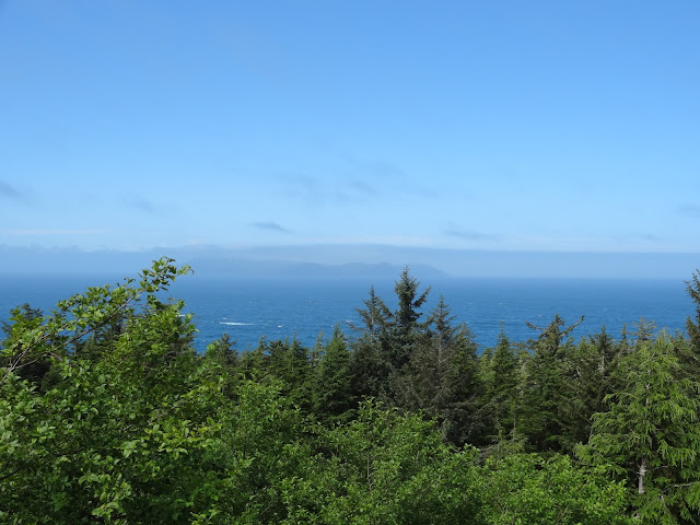 The view from the lighthouse was not particularly interesting. However there was a cat to pet, and water was available from a tap. Despite having to haul it 6km to get it back to Nels Bight I took full advantage of the tap water and filled up all the bottles and the 4L dromedary bag. This water you did not need to filter, and it was clear (no jungle piss here) . Then I hauled the majority of that (I took the bag) back to camp while Heath took the rest. It was a good thing too, the creek at the western edge of Nels Bight was terrible. Supposedly there was a source and a bowl it flowed into, in the forest between the creek and the sign. Several people told us about it. I never tried to look for it, but Heath never found it the next morning when for once we had to get more water after drinking too much the afternoon before, and actually running out at breakfast. He instead filtered us some jungle piss from the visible creek. In the guest book on the bus one person also mentioned they could not find this mysterious but often referred to bowl.
 Guise Bay
 Experiment Bight. Stronger waves on this beach.
 Nels Bight. Its very large and that is a good thing. This beach had tons of people camped on it. Most of them older than us. Good for everyone getting out here and enjoying a beautiful weekend (for it was the weekend again).
 Sunset.
Day 7 - July 19, 2015 - Nels Bight to San Josef Bay
Another hot day with very little cloud cover. All of it inland, only passing a lake on the way. Since the bus leaves at 1-2pm there was no reason for us to skip San Josef Bay which some people refer to as the nicest beach in Cape Scott Park. With so many kilometers to cover it would have been hard to catch the bus in time on this day anyway. Instead we camped one more night and slept in the next day.
 After many hours of somewhat boring hiking we got to Eric Lake. The water was pretty clear, it might have been nice for a swim, but with still more to hike it wasn't appealing enough to try.
 At the junction with the parking lot we get to this. What is this??? While the trail in the rest of Cape Scott is pretty nice compared to the North Coast Trail, this was again even easier to hike on. The entire section from the parking lot to San Josef Bay was like this: graveled and wide enough for two people to walk side by side. Actually it was level enough to get a wheel chair down if you wanted to. It was weird after so long in the jungle (forest).
 San Josef Bay
 San Josef Bay
 There are two beaches at San Josef Bay. While there is an inland trail between them, it is reminiscent of the NCT. We opted out of that, and instead waited till the time was close to low tide, and instead crossed to the second beach on the beach at around 8pm. Why did we need to go there? Not just to see the sea stacks, but the water source is over there. This makes this water source almost worse then Nissen Bight for access. Its not a long hike, but it is a pain to wait for low tide.
 Sea stacks
 Bit of sandy beach in between beaches.
 Same
Same
 Looking back at the section that is the major reason to wait for the lowest part of low tide. We went a few hours earlier than the lowest tide time, and we got our feet wet (we were wearing sandals by this point) on the way in. Less so on the way back.
 On this second beach there was a large tidal beach pool. The only one on the trail I found. It would have been nice to swim in this if it had been earlier in the day, but by this time we were pretty tired and just wanted to get the water back to camp.
 Second beach. The water source on the east end of the beach was very very low flowing (and therefore of course jungle piss). You could barely submerge your filter hose in it. Someone told us there was another creek on the west side, but another party said they tried over there and couldn't find anything. At least we had this nice view to look at.
The next day there are no pictures. It drizzled during the night and into the morning while we broke camp and hiked out. The night before I'd eaten a bad freeze dried dinner or something and wasn't feeling well all night and into the morning. The hike out was a short march of 36 minutes. At the end, even though it was only just past 11am, the trail shuttle was already there! Since we were the only ones taking it, we got to leave right away and got back to Port Hardy much sooner than I expected. It was very nice of the company to send the shuttle so early.
All in all I recommend this hike, especially if you like solitude. While the shelf, beach hiking, and water sources are all nicer on the WCT, the NCT trail has better beach camping and of course less people. The pocket beaches are very neat and scenic, even if they are all pebble beaches which become tedious to hike on. The ropes were a nice change from ladders which can scare me with my fear of heights. It makes sense to take the time to do the NCT slowly, rather than march through it quickly. But that is just my opinion.
(Part 1 - North Coast Trail Section)
Day 6 - July 18, 2015 - Nissen Bight to Nels Bight, then up to Cape Scott Lighthouse and back
This day was cloudy on and off, but finally beautifully sunny as we sat on the long white sandy beach of (very busy) Nels Bight.


Day 7 - July 19, 2015 - Nels Bight to San Josef Bay
Another hot day with very little cloud cover. All of it inland, only passing a lake on the way. Since the bus leaves at 1-2pm there was no reason for us to skip San Josef Bay which some people refer to as the nicest beach in Cape Scott Park. With so many kilometers to cover it would have been hard to catch the bus in time on this day anyway. Instead we camped one more night and slept in the next day.


The next day there are no pictures. It drizzled during the night and into the morning while we broke camp and hiked out. The night before I'd eaten a bad freeze dried dinner or something and wasn't feeling well all night and into the morning. The hike out was a short march of 36 minutes. At the end, even though it was only just past 11am, the trail shuttle was already there! Since we were the only ones taking it, we got to leave right away and got back to Port Hardy much sooner than I expected. It was very nice of the company to send the shuttle so early.
All in all I recommend this hike, especially if you like solitude. While the shelf, beach hiking, and water sources are all nicer on the WCT, the NCT trail has better beach camping and of course less people. The pocket beaches are very neat and scenic, even if they are all pebble beaches which become tedious to hike on. The ropes were a nice change from ladders which can scare me with my fear of heights. It makes sense to take the time to do the NCT slowly, rather than march through it quickly. But that is just my opinion.
(Part 1 - North Coast Trail Section)


