
Sawback Range Circuit Backpack - Banff, AB July 26 - 31, 2014
A weekend warrior such as I, only gets a couple of big trips in a season. So why, in some people’s opinions (*that book we all know of*), ‘waste’ one on the Sawback Range Circuit? For me it was to see a large swath of Banff National Park that a lot of people (who are not commercial horse packers or their clients) do not. There was also the lure of three passes in one trip. And who can resist a loop? Really, who can? Not me.
Highpoints. The three passes of course. Some lovely meadows
and subalpine forests around them as well.
Lowpoints. The 2013 floods have washed away several sections
of the trail. The area around Flint’s Park didn’t even feel like the Rockies to
me and was boring. A lot of the other forested sections were also boring.
This is described clockwise, which is better as the
approaches to the two passes you traverse are much easier that way. It does
give you the passes in sort of the wrong order to appreciate them best. But
that is a small price to pay. Just do the hike on the east side of Badger Pass
and tell me it is not so.
To begin there is a boring ascent through forest in Moose
Meadows to get onto the day hikers track to the ink pots from Johnston Canyon.
A short section of this and we descended down to the ink pots which are nice enough,
but there was a long way to go ahead so we did not linger here. After leaving
the ink pots and the day hikers behind we soon crossed the river on a new bridge
then there was a short section on flats in the open, till finally hiking through forest until Larry’s
Camp.

At the inkpots looking ahead to where we are going.
The trail between Larry’s Camp and the Luellen Lake turn off
is dull. The trail is rocky, rooty, and muddy. It is also carved up by horses.
Luckily we came during a very dry part of the summer. Though it had rained in
the previous days, most of the mud holes had dried out. This
made sections of the trail much more bearable then they must be in a rainy
season. Here we encountered the first washed out section of trail, however you don’t
even see it due to a great newly cut diversion path that Parks made. While still
rooty, and a bit muddy at stream crossings, it is a break from the general mud
and roots and rocks of the main trail. It was clearly flagged from the south side where to turn off and ascend the new trail. Finally we arrived at Luellen Lake, which is a nice enough lake, and
camped for our first night.


Luellen Lake.
The next day the trail continuing on to Badger Pass Junction only got better. After
more of the same we finally came out into meadows. The trail went through some, but also skirted some in the forest. We passed a
large commercial horse camp in the first meadow. Once in the second one we were finally neared the Badger Pass campground.

Sorry for the ever present water-spot in the photos starting here. I got a fingerprint or something on the camera and didn't notice for days. Some photographer I am.

Nearing Badger Pass Junction campground which is in the trees ahead. Pulsatilla Pass, which is further on is semi-visible as well.
Pulsatilla is the first pass we got to. We did it as a side trip from the Badger Pass Junction campground that same day, since the walk from Luellen Lake to the campground is not very far and has minimal elevation gain. This was not one to miss. It is the most pretty, with its large blue lake (Pulsatilla Lake) down on the
north side. The meadows and sub-alpine larch forest on route from the south are standard
Rockies best, though short lived. There were also some neat tiny waterfalls in the creek to see on the way there.

Tiny waterfall.


Looking back south as we descend back to camp from the pass. This is a bit down from the crest of the pass but shows a better view of the valley we came through.
The next day we continued on the approach to Badger Pass which starts by gaining
a crest above the river that gives a view up valley to the pass
with several small waterfalls along the river.

The view mentioned above.
Then on the way to Badger Pass from the west there was a
washout for a small section again. Following the river for a few meters we got to a flagged section and trampled
path that traverses the new steep banks of the creek, and has several ups and
downs that are very steep and seem unnecessary. None that are so bad we were starting to curse our luck though. By the time we got to that point we were back on
good trail. A better trail farther in from the creek to the north would be much nicer and I hope Parks has the time/money to do that in the future.

Heading to Badger Pass.

After the washout sections and back on the good regular trail that at first is near this stream with more miniature waterfalls.
The rest of the trail to the pass is good and not even very steep except for a short section.

Out of the trees nearing Badger Pass which is visible in the distance below that unnamed peak.

Looking back down valley from the same spot.
Badger Pass may not be the prettiest of passes but it is the most dramatic of the three in this loop. The tops of the peaks around us did not seem that much higher. A scree trail looked to ascend to a col between Bonnet Peak and an unnamed high point to access Bonnet Icefield. The trail on the other side plunges down into the forest right until it take a turn to the east towards Block Lakes Junction.


The trail plunges down to the south after that. It is a good trail except for a very short bit of creek washout before a willow section. It continues to be good until it stops descending and takes a turn to the east. There is even an interesting bit of the creek you get to see in the trees.


Interesting bit of the creek.
The real "fun" is in the washouts around Block Lakes Junction, at least until they fix it up some more. When coming from Badger Pass from the west we got to a section of
trail were the creek simply decided during the floods to use the
trail instead of its original path. It then flooded a large area of forest.
When we were there we were lucky the creek wasn't overly high in flow volume and there were bits of
sand bank and vegetation to hop from one to the other following intermittent
flagging to the end of this
section.

Lack of trail.
The next bit of washout we encountered was much easier, with a newly cut trail to the north (the
side farther in from the creek than the original trail) making travel easy.
Parks had their work cut out for them cutting down all the trees to make this
one. It appeared that they had only made it recently as well. After that the only problem until we got to Block Lakes Junction were some small steams without bridges over them. No big deal.

Stream with no bridge.


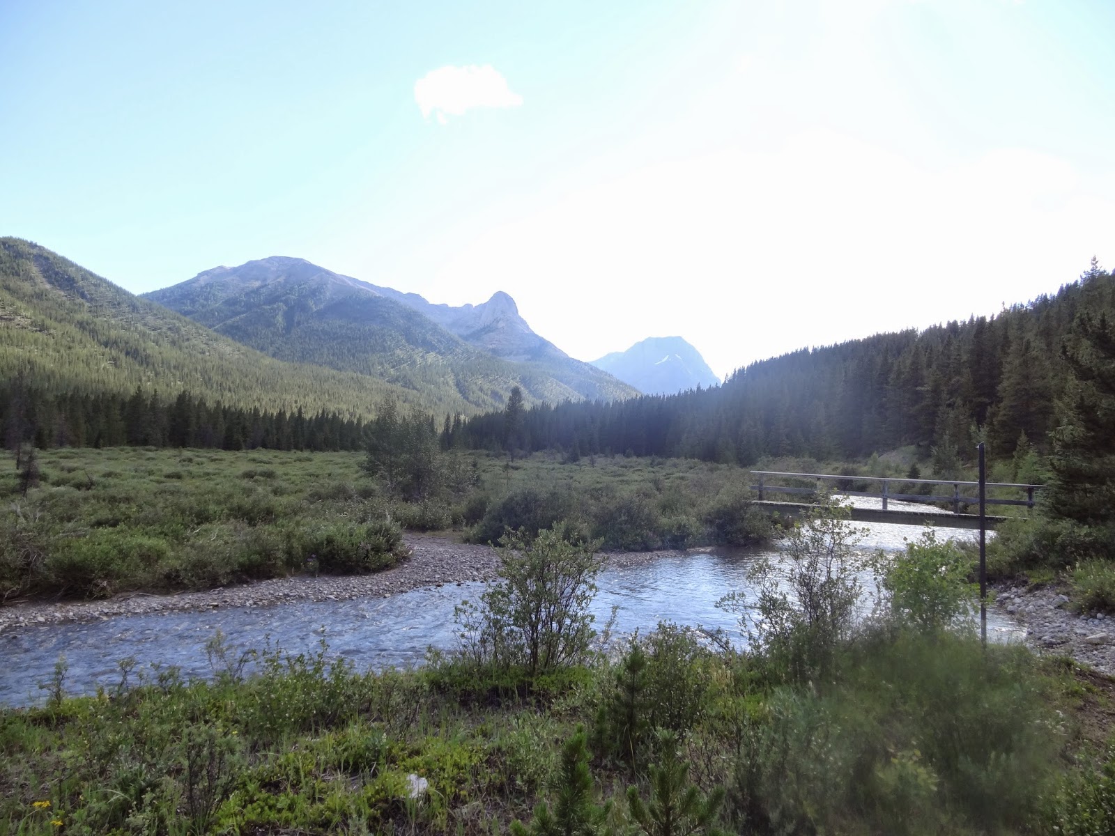
View back west from near Block Lakes Junction.
We were continuing on to keep to our schedule of doing the loop in 5 days so we didn't feel we had time/energy for the Block Lakes lookout. I'm not even sure how you can see the lakes from the lookout as they are much higher up. Then after Block Lakes Junction we got to the third washout of this
section of the loop. It was for us the worst, as we had to cross the stream twice despite
our desire not to (because the map does not show that this is the way, the old trail stuck to the north side of the stream). There
are only three pieces of flagging we saw, two to led us over the creek and
onto the dry gravel flats where it once lived. Then one led us back off of
the gravel flats through a few trees and to another crossing of the stream to
the trail, which thankfully ascends ever so slightly but significantly there into
the forest where it is safe from damage. I hummed and hawed over
committing to cross the steam at first looking for a way on the opposite bank.
People had obviously done the same and worn down a path in the underbrush for a bit. It
basically lead to a bushy swamp where the old trail descended into the water of the new stream course. We
eventually gave in to logic and took off our boots to wade across and get onto
the gravel. Boots back on we continued down that for several meters only to find we
needed to take them back off so soon we probably shouldn't have bothered and just simply tramped along in our flip flops for that section.

Trail after the washout between Block Lakes Junction and Flints park. After this it only gets more open, flat and dull.
The hike from there towards Flint’s Park is along a flat previous road through forest that felt to me like it belonged more on nose hill park in the
foot hills than in the mountains. After our long day it was a truly boring
section made worse by blackflies. There was only one interesting thing to note,
and that is the frogs. I have never seen so many frogs in the Rockies as around Flint’s Park ever. Flint’s Park was damaged in the floods, so that there was only one tent site that was not
covered in river silt. Luckily we were the only ones crazy enough to camp there that
night. A fire in the grate from all the dead wood along the flood plain finally
regained our spirits after the long day. That was the one really nice thing about this whole trail, unlike most of the campground is other areas of the Rockies, all of these campgrounds allowed fires and had grates at them.
Looking back west from near Flint's Park campground.
The next day the hike from Flint’s Park to Forty Miles summit was along
another wide track that was probably also previously a road. It is boring and viewless until we got to the turnoff to Sawback Lake. After a steep but short
ascent to Forty Mile Summit area we got to walk along the longest meadow
imaginable - in such an area after such a march. I know there are longer meadows
but this flat section was truly appreciated after what came before. Then after
descending only a short ways hikers get their own track, and we descended down
through a more 'proper' looking Rockies forest without the mud caused by the horse packers.

Looking towards Sawback Lake. We also didn't feel we had the energy/time for this side trip.


Looking back from near the end of the meadow.
Side note -> I love my new Osprey backpack!
After descending down to another trail junction we then turned west and started ascending into Mystic Pass. That was again
through 'proper' Rockies Forest, however it was a forest just covered in spider webs.
This was the most spider webs I’ve ever seen in the Rockies. Thankfully because of this, the Mystic Pass Campground was almost devoid of mosquitoes and black flies. If it
were not for the awful red flies that occupied the toilet when we were there, it
would be the perfect bug free camp in this loop at a time of year you cant really expect to be bug free. Maybe not the best situated, but not bad.
The next morning we first made the very short side trip to Mystic Lake. Which was quite lovely as it was very still and reflective at that time of day.

Mystic Lake.
 Mystic Lake.
Then we continued on to Mystic Pass. Once near treeline there was a lovely short section of larch subalpine forest with plenty of wildflowers. The pass itself is the least impressive of the three, and hiking
them in this order does tend to draw out what it lacks. It is not a very high
pass, rising barely above treeline. The views are ok, but it is not dramatic,
nor pretty without any lakes visible. Still we enjoyed the view while we took our break at the top.

Creek on the way to Mystic Pass.


The trail afterwards then takes a turn to the west and descends quite steeply, at least at first, back down to Larry’s camp.

After the turn to the west looking down valley towards Larry's campground.
A few more flooded sections greeted us on the descent from
Mystic Pass back down to Larry’s Camp. All were cairned and/or flagged and were easy to follow. A note though that some of the cairns; while taking you where
you want to go by the shortest route, do trend to keep you on gravel or boulder
sections longer than necessary, if you stayed further north (climbers left, skiers right)
there are sections of decent trail to walk on instead, when the cairns would lead you to
walk along gravel/scree just for the hell of it. Not a big deal though.
At Larry’s camp having finished
the looping part of the hike we almost felt like we should have been done. The
motivation to trudge the 7.9 Km back to our car down the forested trail, through
the flats, around the ink pots, then back up and down through more uninspiring
forest had to be found in the goodies we would purchase and devour (nachos and beer) when back.


Map of the area, red line approximate route (not to be confused with the orange lines, which are roads). It is from http://
One last note, that we were super lucky in our weather on this trip. It never rained once or even clouded over significantly. It was so much sun and good hot weather we actually started to run out of sunscreen (bad planning) and wish for the cover of trees while going through passes in midday. My coworker was right when I was listing things you appreciate more after a backpacking trip (like clean running water) when she added "constant temperature" to the list. Still, we felt very lucky to not have the rain or the cold with us as that is always worse.
How was the water supply per day?
ReplyDeleteIt was fine. No shortages, and no really bad water supplies.
DeleteGreat writeup! I did this loop this past July over 4 days. The highlight for me was the overnight at Sawback Lake (I've never seen more frogs in one alpine area in my life!), and not running into any other hikers after leaving Luellen Lake until Mystic Lake. Weather was generally rainy and Badger Pass had quite a bit of new snow even in mid-summer.
ReplyDeleteThat's too bad about your weather, we were really lucky with our weather. I am slightly disappointed we didn't see Sawback Lack. I didn't know that it had a large population of frogs! That is neat. My original plan was to camp there after Badger Pass Junction campground. But then I looked at the numbers again and decided we couldn't make it. And we couldn't have in the heat we had. 4 days is impressive. You did Luellen to ? then Sawback, and Mystic Lake and out.
DeleteI'm thinking of doing this same loop in month in early July. My camp plan is Larry's, Badger Camp (time for dayhike to Pulsatilla), Sawback Lake, and Larry's. Snow is mostly melted already they tell me and I can only hope bugs and rain won't be bad. I won't go if the forecast is not solid.
ReplyDeleteNice, hope you get good weather!
Delete