
North Coast Trail & Cape Scott Trail - Cape Scott Park, BC July 13 - 20, 2015
(Part 1 - North Coast Trail Section)
After completing the West Coast Trail (WCT) two years ago I'd always wanted to go back and complete another coastal hike. I cannot remember how I heard about the North Coast Trail (NCT), but the fact that it had far less people hiking on it every day was very appealing. It was also advertised as more rugged and wild than the older WCT. During the previous winter I decided it was time to go back to Victoria island and complete this trail (rather than say, the Juan de Fuca or the Nootka which I will most likely do in the years to come).
To get to the trail head for the NCT it is necessary to take a shuttle boat from Port Hardy, which then on the way back makes it necessary to take the shuttle bus back from the Cape Scott trail head. These costs (depending on how many people are booked on the days you are going) make this trip somewhat similar in cost to hiking the WCT, even though the actual trail fees are much cheaper ($10/day/person). I had booked the shuttles beforehand, but the actual trail does not need to be booked because currently there is always plenty of space.
The day we were driving up to Port Hardy it poured rain for about an hour or two. I was worried it would do so the next day, but we were lucky it did not. This was after a long dry spell in weather on the island. The weather forecast wasn't too great, but not terrible. It looked like we would probably have a good trip (nice enough weather and relatively dry trail).
The shuttle boat leaves at 8am and takes about half an hour to get to Shushartie Bay, where there is no dock and you must get off the boat by stepping onto rocks along the coast. This was relatively easy for us, so personally I don't see need of a dock here. Then the boat leaves and your only option to get back to civilization (besides calling for rescue) is to start hiking.
Day 1 - July 13, 2015 - Shushartie Bay to Skinner Creek
This day was mostly overcast with only light rain for about an hour. It was completely inland.
 Boat ride out to Shushartie Bay. We saw an otter on the way out, but I didn't get a photo.
 Nearing the NCT trail head, which is the sign on the shore.

 The trail doesn't bother easing you into the hike, it starts you off with a steep section including the first rope to help you up. You gain a fair amount of elevation (for a coastal trail) in the first kilometer.
 Then you are left in the forest scrambling over trees and roots and stomping through mud holes. This isn't the best picture, as the trail you can see here is clear for this section.
 The forested trail is punctuated by sections of boardwalk through meadows and short stunted trees. We sat down here for our first break (an hour had passed) and right afterwards it started sprinkling on us for about 3/4 of an hour.
 Next section of trail was significantly more muddy than the first part.
 After 4 & 3/4 of an hour we made it to Skinner Creek campground. You must scramble through a bit of a log jam at the end of this creek to get out here onto the beach, then you must cross Skinner Creek (low this year) to get to the campground. The bear lockers are up on that section of land near the center of the photo. Skinner creek has a good water just barely upstream of those logs.
 Bald eagle hanging out on the beach. Saw two more that evening.
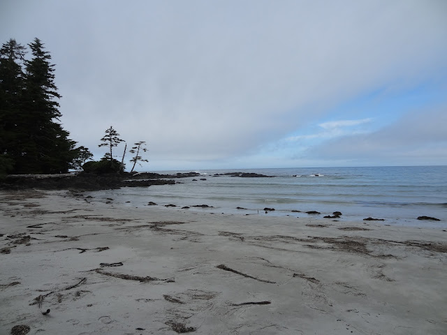
 More of the beach near Skinner Creek.
Day 2 - July 14, 2015 - Skinner Creek to Cape Sutil
The second day we woke up to party cloudy skies. We headed out early because the section of trail after the cable car crossing was listed as very difficult on the map.
 Walking along the beach at Skinner Creek in the morning. It says on the map you can only pass this section at low tide, but I didn't see anything that looked too treacherous to pass at high tide, so I'm not sure why that is. The beach seemed to go up far enough to pass at high tide at least, but I could definitely be wrong. Maybe its worse at times of year when the tide is higher.
 After a very short section in the trees we ended up on a cobble (stone) beach that leads to the Nahwitti River and campsite. This is one of the only campsites that sits on a cobble beach rather than a sand beach, and with the absence of good water (you have to go pretty far up the river to get away from the tidal section) I cannot recommend it at all. Cobble beaches were very common on this trail rather than sand ones. They would become tedious in the days to come.
 Descending the cable car platform on the other side of the Nahwitti River cable car crossing. This was the highest ladder on the trail (as there were no ladders in the forest, all sections use rope instead).
 Starting the hardest section of the trail. Crossing a creek near the beginning of the - every step is over a root, tree or through a mud hole - section. Still not too much harder than the day before.
 A bit of relief in more open forest closer to the coast.
 Going back inland to denser forest and trickier trail.
 Out on the cobble beach again. The trail goes inland for a while and then onto another section of beach, that includes some caves. This part is actually not passable at high tide, but we were just in time to not get wet going past the caves.
 After that section you get to the 'funnest' headwall / rope section. First you go up this, which isn't so bad.
 Only to come to a piece of land that is only a foot wide and see you must go down two more ropes that take you almost back down to the next beach.
 This is looking up. Not only do you have to go over that tree on the first rope. The bottom of the second one is wet and the gravely slope is steep and wet. You get almost no traction, so you have to keep good hold of the rope. Someone wrote in the washroom guestbook at the next campsite it made them feel like Tarzan. In the guest book on the shuttle bus back a few people said this should be replaced with a ladder. I don't agree unless tons of people get hurt here. This is what the trail is known for and its almost fun. Especially in retrospect (type II fun).
 Then after a few more up and down sections of beach and headwall you get to Cape Sutil beach which is all sand. Its a nice beach, but the water source is far away from the pit toilet/bear locker and its not a very good one either. Not tidal, but low flowing and very yellow (jungle piss as I like to call it).
 Camp. The skies cleared up and we got a nice sunny evening. All the pit toilets had toilet paper dispensers which were usually full, which I found very nice and very odd. This one had a guest book as well. My favorite entry was "the Germans are coming". Not referencing any world war I am sure, but rather that Germans are known to come over to Canada to hike our harder and far less crowded (than in Europe) trails, and the NCT is a perfect example (currently) of a less crowded but hard trail. This is true because when you look at the guestbook in the shuttle bus the vast majority of people from outside of Canada are Germans. I had already been arguing this point with Heath just two days before, so it was nice to be validated by a toilet guest book if nothing else.
Day 3 - July 15, 2015 - Cape Sutil to Shuttleworth Bight
We woke up to fantastic news from the trail wardens who have a hut farther down the beach: the fire ban had been lifted from our area and we could have beach fires again! We had not been able to the first two nights due to a province wide fire ban due to the dry conditions and many forest fires already burning throughout BC.
 The day started out with a short inland section which was easy.
 This lead to some pocket pebble beach sections. In and out of the forest.
 Pebbles are so much fun....
 Another one.
 There were a couple longer inland sections after the first set of beaches.
 Another beach. Mostly pebbles.
 A longer pebble beach. It started to cloud over and almost sprinkled on us, but couldn't really commit to it. We saw a lot of boats out on the ocean these first three days, mostly fishing vessels probably. I wondered if they could see us, and what they thought about what we were doing. Often I wondered if they were drinking beer at that very moment....
 Another short beach section on the "sutil scramble". As much as I would love to walk on that sand there, these sections are so short you almost want to stay on the higher pebble section to save time hiking on and off the beach.
 After some more pebble hiking we finally got to Shuttleworth Bight where right at the campsite the pebbles and dead sea grass ended, and the nearly white sand beach started. However it was quite cloudy on the beach and I opted to get the tent off the ground (sand), so I camped in the inland section of the campground which included tent pads here. I had taken four eye screws with me just for this to make it easier to secure the tent to the platforms. They worked really well and it was easy enough to rig up the other tent lines.
 After about half an hour of arriving at camp the sun came out and we went out onto the beach to enjoy our fire and the sunset. This camp was next to Irony Creek which is a good larger creek that is only tidal for the first few hundred meters. Doesn't take that long to get up the first few little steps to ensure good water (and not too yellow).
 Start of the sunset.
Day 4 - July 16, 2015 - Shuttleworth Bight to Laura Creek
We woke up to a beautiful day, and a nice long walk along the low tide line shore of sandy Shuttleworth Bight. The longest sand hiking section on the trail (unfortunately), we were in for a lot of pebbles and sea grass today. This section is nearly all along the shore, especially at the end of the day where you don't have to go inland for hours on the last stretch to Laura Creek. Again the rocks only stop right at the campground and then some sand begins.
 Looking back at our sandy beach hiking.
 In the middle of the only long inland section today was the second cable car crossing over Standby River.
 More pocket pebble beach.
 Looking back.
 Some gravel, and some shelf. There is shelf only on this days section of the trail, but most of it is too uneven and broken up to be much good for hiking. Not like the WCT at all, which had very lovely shelf sections on many days.
 Looking out to sea.
 Starting out on the long section on the coast.
 Rounding a corner, and getting even hotter this day.
 Finally past Laura Creek and near the campsite. The pebbles end and sand begins. Laura Creek is similar to Irony Creek. Only tidal for a few hundred meters and then a few little steps ensure good water.
 Fire!
Fire!
 Sunset
 Sunset
 Sunset
Day 5 - July 17, 2015 - Laura Creek to Nissen Bight
This day started cloudy and didn't improve until right at the very end of the day when the sun was setting. It didn't rain at any time though. At camp I was getting chilly from the damp cold (which I am not used to being from super dry Calgary) and was sure glad to have a beach fire this evening.
 Looking back, at the end of the beach, towards Laura Creek campsite.
 This day was all inland again but the trail was easier than it was before. More boardwalk, more sections that looked like the above - clear to walk on for quite a few steps without looking down at your feet.
 Crossing one of the only creeks without a bridge of some sort.
 Laughing Loon Lake.
 A meadow section mostly covered in boardwalk.
 Nissen Bight. The campground is on the west end which is much nicer, it has a lot more sand. The other end of the beach is mostly pebbles again and sea grass. But it is the end with the water. A slightly lower flowing creek (as in it produces jungle piss) than the last two, comes out on the east end of the beach. Which is a full 900 meters away from the campground. Since that is the end you come out on when hiking the NCT (about 100m too far west but close enough), I opted to filter all the water with full backpacks on and then go to the campsite afterwards. Instead of dropping them back off, setting up camp, and only sending one person back like we had done the last two nights. This campground in particular was why I'd finally bought a four liter MSR dromedary bag. We'd started using it on the second night and it was super nice (creek far away or not) to only filter water in the evening, and not having to go out and do so again in the morning after breakfast to ensure there was enough water throughout the day. I strongly recommend bringing one on this trip, and I think I will take it everywhere from now on.
 A (probably adolescent) whale was out in the ocean near the beach for about half an hour. This was about as much of him/her we saw though.
 Also saw this green crab.
 Sunset. This ends the newer North Coast Trail section of the hike. The next day we would be hiking in the older Cape Scott Park. This night we had two other groups camping on the beach with us (they had walked in from the Cape Scott parking lot), the first time ever. Every other night we had been alone (if you don't count the trail wardens in their hut down the beach on the second night, though I suppose you should count them).
(Part 2 - Cape Scott Trail Section)
To get to the trail head for the NCT it is necessary to take a shuttle boat from Port Hardy, which then on the way back makes it necessary to take the shuttle bus back from the Cape Scott trail head. These costs (depending on how many people are booked on the days you are going) make this trip somewhat similar in cost to hiking the WCT, even though the actual trail fees are much cheaper ($10/day/person). I had booked the shuttles beforehand, but the actual trail does not need to be booked because currently there is always plenty of space.
The day we were driving up to Port Hardy it poured rain for about an hour or two. I was worried it would do so the next day, but we were lucky it did not. This was after a long dry spell in weather on the island. The weather forecast wasn't too great, but not terrible. It looked like we would probably have a good trip (nice enough weather and relatively dry trail).
The shuttle boat leaves at 8am and takes about half an hour to get to Shushartie Bay, where there is no dock and you must get off the boat by stepping onto rocks along the coast. This was relatively easy for us, so personally I don't see need of a dock here. Then the boat leaves and your only option to get back to civilization (besides calling for rescue) is to start hiking.
Day 1 - July 13, 2015 - Shushartie Bay to Skinner Creek
This day was mostly overcast with only light rain for about an hour. It was completely inland.


After being dropped off with another group the boat leaves us alone on the trail. It is quite odd watching the last of civilization drive away on you. The other group would be completing double sections each day for the first two days (when I say sections I mean the portions of trail as described on the map, which correspond to our itinerary) so we would not camp with them. Although I knew we could probably hike some double sections, I had opted for a slow steady pace which allowed plenty of time at camp to enjoy the beach/ocean. I was on holiday after all.


Day 2 - July 14, 2015 - Skinner Creek to Cape Sutil
The second day we woke up to party cloudy skies. We headed out early because the section of trail after the cable car crossing was listed as very difficult on the map.


Day 3 - July 15, 2015 - Cape Sutil to Shuttleworth Bight
We woke up to fantastic news from the trail wardens who have a hut farther down the beach: the fire ban had been lifted from our area and we could have beach fires again! We had not been able to the first two nights due to a province wide fire ban due to the dry conditions and many forest fires already burning throughout BC.


Day 4 - July 16, 2015 - Shuttleworth Bight to Laura Creek
We woke up to a beautiful day, and a nice long walk along the low tide line shore of sandy Shuttleworth Bight. The longest sand hiking section on the trail (unfortunately), we were in for a lot of pebbles and sea grass today. This section is nearly all along the shore, especially at the end of the day where you don't have to go inland for hours on the last stretch to Laura Creek. Again the rocks only stop right at the campground and then some sand begins.


Day 5 - July 17, 2015 - Laura Creek to Nissen Bight
This day started cloudy and didn't improve until right at the very end of the day when the sun was setting. It didn't rain at any time though. At camp I was getting chilly from the damp cold (which I am not used to being from super dry Calgary) and was sure glad to have a beach fire this evening.


(Part 2 - Cape Scott Trail Section)
Hi, How long was this trail?
ReplyDeleteThe North Coast section is 43.1km. But to get back to the parking you still have to hike 15km in Cape Scott Provincial Park. The North Coast Trail was built as an extension to that trail.
ReplyDelete