
Woodbury to Silver Spray Traverse - Kokanee Glacier Provincial Park, BC August 1 - 4, 2015
(Day 3 - August 3 - Ascent of Sunrise Mountain)
I had vaguely planned to ascend both Mount McQuarrie and Sunrise Mountain on this day after the traverse. I decided to do Sunrise Mountain first, as it looked like it might be more fun. Actual scrambling rather than just toiling up boulders/rubble. After some route-finding issues described below, it look me longer than anticipated to complete the ascent. That plus being super tired, plus it looked like rain would come in (it did just before 6pm), meant that I decided to relax rather than go for the second ascent.
First I had to find the trail to McQuarrie / Sunrise col. The book states its to the south of the hut and goes around the small tarn then turns north. It took a while to find it, as the trail south just keeps going south and fades away, not turning north around the tarn at all. I did find a trail up on rocks to the north-north-west of the tarn eventually though. It joined up with a more distinct trail that came from an offshoot of the trail that goes to the bivy near the hut. This is the way that you should actually go to the McQuarrie / Sunrise col. It makes more sense and is easier. After that, the trail was easy to follow to the col.
 After a few minutes ascending on the trail looking back at the hut. Really you can just walk cross country to this point, and on-wards to the col. However my this point I was kinda into trails after yesterday, and was happy to finally find it.
 Going along the trail to the col.
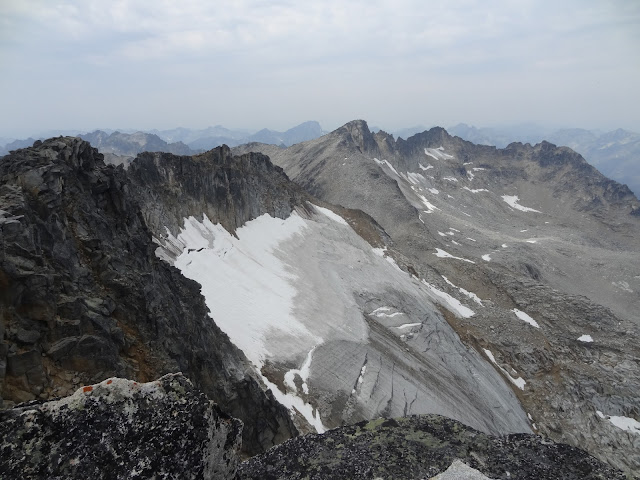
 Sunrise Mountain. On the way down I would go down the brownish scree just after the first high-point on the ridge to the left. It descends in a shallow gully feature all the way to the cliffs above the hut.
 Another larger tarn on the way to the col.
 Trail again.
 Looking up at the initial slopes of Sunrise Mountain from the col.
 View north through the col.
 Boulders on ascent.
 Boulders on ascent.
 At a flat section, where the alternative descent down the brown scree starts. From here I went up to the false summit in view here, when I should have already started traversing around the climbers right (south) side on ledges to bypass the hardest part of the ridge. I would only figure this out after sitting on the false summit and pondering giving up, then trying to find a way down to the ledges from up there, and then finally going nearly back to here and finding the actual ledge route. Which is cairned and easy to follow.
 View down to the glacier from the false summit.
 View along the summit ridge to the summit, which is the last high-point on the ridge. However I cannot get down from here along the ridge without at least 5-6 very exposed difficult moves, so I had to take the easier ledge route, which I could not find at the time.
 I have many pictures of the ledge route on the return. On the way there I was just so glad to have found it that I didn't take any. So this is on the next high-point when the ascent becomes nothing more than scrambling over boulders again. Sometimes you have to move slightly off the ridge to climbers right to make things easier. But nowhere near as low as the ledge route from before.
 Looking back.
 On next high-point looking towards the summit. All these false summits are annoying, even if you have seen them before, and should totally be prepared for them.
 Summit looking northwest.
 Summit looking north.
 Summit looking northeast.
 Summit looking east.
 Summit looking southeast.
 Summit looking south.
 Summit looking southwest.
 Summit cairn.
 View of Glacier View Peak and others to the southwest.
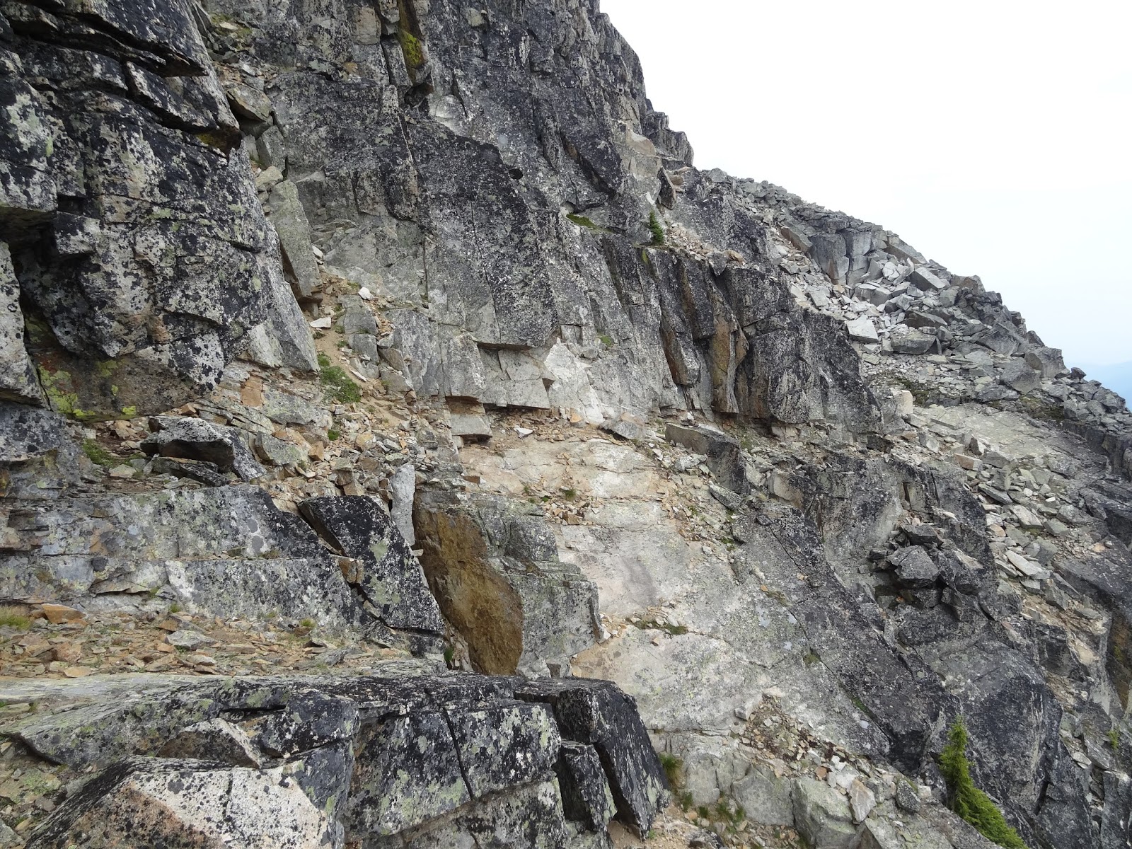
 On the way back after the easy boulder part, this is very near where the ledges start/end.
 Looking back up at the end of the ledge route, where you ascend back up to the ridge.
 Looking on-wards on the way back.
 More ledge.
 This part was trickier than the wide ledge but still easy.
 Ducking under a lichen covered block to continue the ledge route.
 Looking back again.
 Looking on-wards. Above and to the right are where I finally got down onto the ledges. I would continue the traverse on the way back though.
 Looking back.
 Looking down at the hut area.
 Looking back.
 Almost to the flat section.
 Looking back.
 Finally at the alternate descent (can be used for ascent too, to save distance), looking back one last time.
 Looking down the descent.
 Looking up after the steepest part.
 Almost down.
 Nearing the larger tarn above the hut. I took my shoes off an make a half-hearted attempt at thinking about swimming in the water, but it was getting cold outside as the rain came in. If it had been as hot as the last two days I might have done it.
(Day 1 - August 1 - In to Woodbury Hut)
(Day 2 - August 2 - Woodbury Hut to Sliver Spray Hut Traverse)
(Day 4 - August 4 - Out via Silver Spray Trail)
First I had to find the trail to McQuarrie / Sunrise col. The book states its to the south of the hut and goes around the small tarn then turns north. It took a while to find it, as the trail south just keeps going south and fades away, not turning north around the tarn at all. I did find a trail up on rocks to the north-north-west of the tarn eventually though. It joined up with a more distinct trail that came from an offshoot of the trail that goes to the bivy near the hut. This is the way that you should actually go to the McQuarrie / Sunrise col. It makes more sense and is easier. After that, the trail was easy to follow to the col.


(Day 1 - August 1 - In to Woodbury Hut)
(Day 2 - August 2 - Woodbury Hut to Sliver Spray Hut Traverse)
(Day 4 - August 4 - Out via Silver Spray Trail)
No comments:
Post a Comment