
Floe Lake Backpack & Ascent of Numa Mountain (2725m) - Kootenay National Park, BC September 20-21, 2014
This was the second annual larch backpack. Last year we did a backpacking trip around the same time to Twin Lakes / Gibbon Pass / Shadow Lake to see the larches. It rained about half of the trip, which felt like the whole time, but we did see a lot of beautiful larches. Well, I decided that this should be an annual thing. So this year I picked another backcountry larch destination to backpack into. Floe Lake on the Rockwall trail was my pick. I'd done the whole trail back in 2010 in three days, but that was a long time ago and I was willing to go again. I'd seen pictures from other people of Floe Lake area at this time of year and it was beautiful. Also I could add on an ascent of Numa Mountain. This one isn't in any scrambles book currently (Kane or Nugara) but I'd seen trip reports and knew that there was an ascent route up from Numa Pass, and that the views looked really good. Unlike a lot of backpacking plus mountain plans of mine, this one turned out really well. I think the trick is that the trip should be short. Longer backpacks should be left alone to simply be backpacks, and not have mountains added onto them.
The weather turned out awesome. There was hardly a cloud in the sky the whole weekend. It was a perfect bluebird weekend to end the summer with. We didn't even need to wear any extra clothes on top of our t-shirts on the summit of Numa Mountain it was so nice. You couldn't even say that of a few of our summer hikes.
The campground for Floe Lake is really nice. We got to camp within the larches there and it has a really great kitchen area on the lake. You couldn't ask for much better. There are a lot of tent sites here though, it could be a pretty crowded camp. When we were there it wasn't too bad.
We got a late start on this trip, on Saturday because of construction on highway one. For some reason completely beyond me they were re-paving perfectly good looking road between the Sunshine turn off and the Bourgeau Lake trail head. It was super annoying. We also got up pretty late due to a house warming bbq the evening before. We started our hike at noon. Oh well, we are super fast hikers. It only took us 3.5 hours to make it up the 10.7km and 697 meters elevation gain. Four years ago when I did this trail it took me 5 hours. I was carrying a bit more, but I was also just not in as good shape. I remember when doing this trail in three days (rather than my planned five due to various reasons), it being one of the hardest hikes I'd ever done. This time we got to the lake with plenty of time to enjoy the sun on the lake shore before it set behind the Rockwall, even though we started so late.

Floe Lake trail goes through an old burn. In the summer it is filled with fireweed. Now that it is fall it is a bit different.

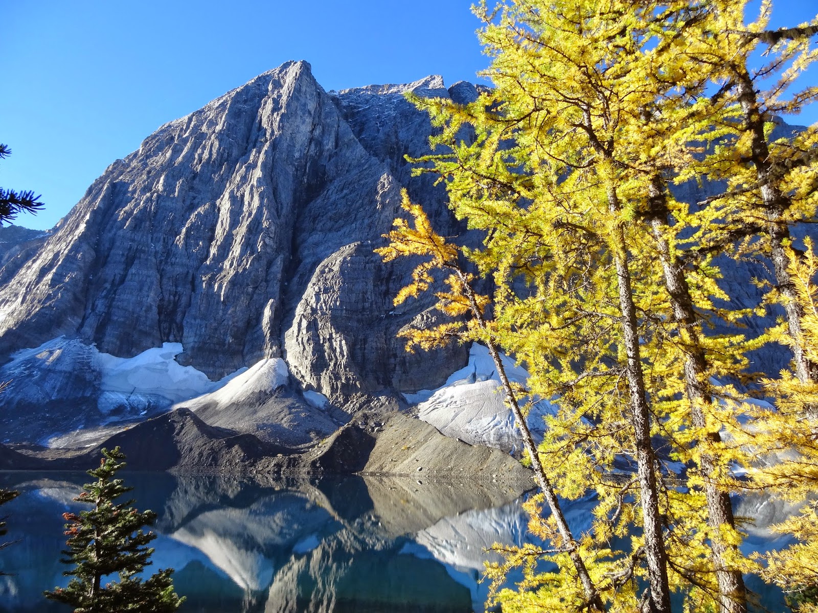
Lake shore before the sun goes down. Since the Rockwall is so huge it blocks out the sun early in the evening and you cant get good pictures of it in the afternoon until the sun goes down. Some of the larches behind me haven't turned yet, but those closer to treeline are all golden.


The best time to get pictures of Floe Lake is in the morning when the light is coming from the east and hitting the west facing wall. The lake was still for us and gave great reflections. Some of the best views ever, but hard to get good photos from around the lake as it just doesn't fit on your camera. We slept in till around 8:30am even though I meant to get up earlier, but thankfully we didn't miss the views before the sun came fully over the horizon.

Floe Lake in the morning.

Another part of Floe Lake.
Larches.


After our breakfast we couldn't linger due to time constraints, but started up our ascent of Numa Pass where we would leave the trail to ascend Numa Mountain. There is a great place just out of treeline to get pictures of Floe Lake and it's portion of the Rockwall.


After ascending Numa Pass we started up the slope to the northeast. It was steeper than the trail of course, but not overly steep.

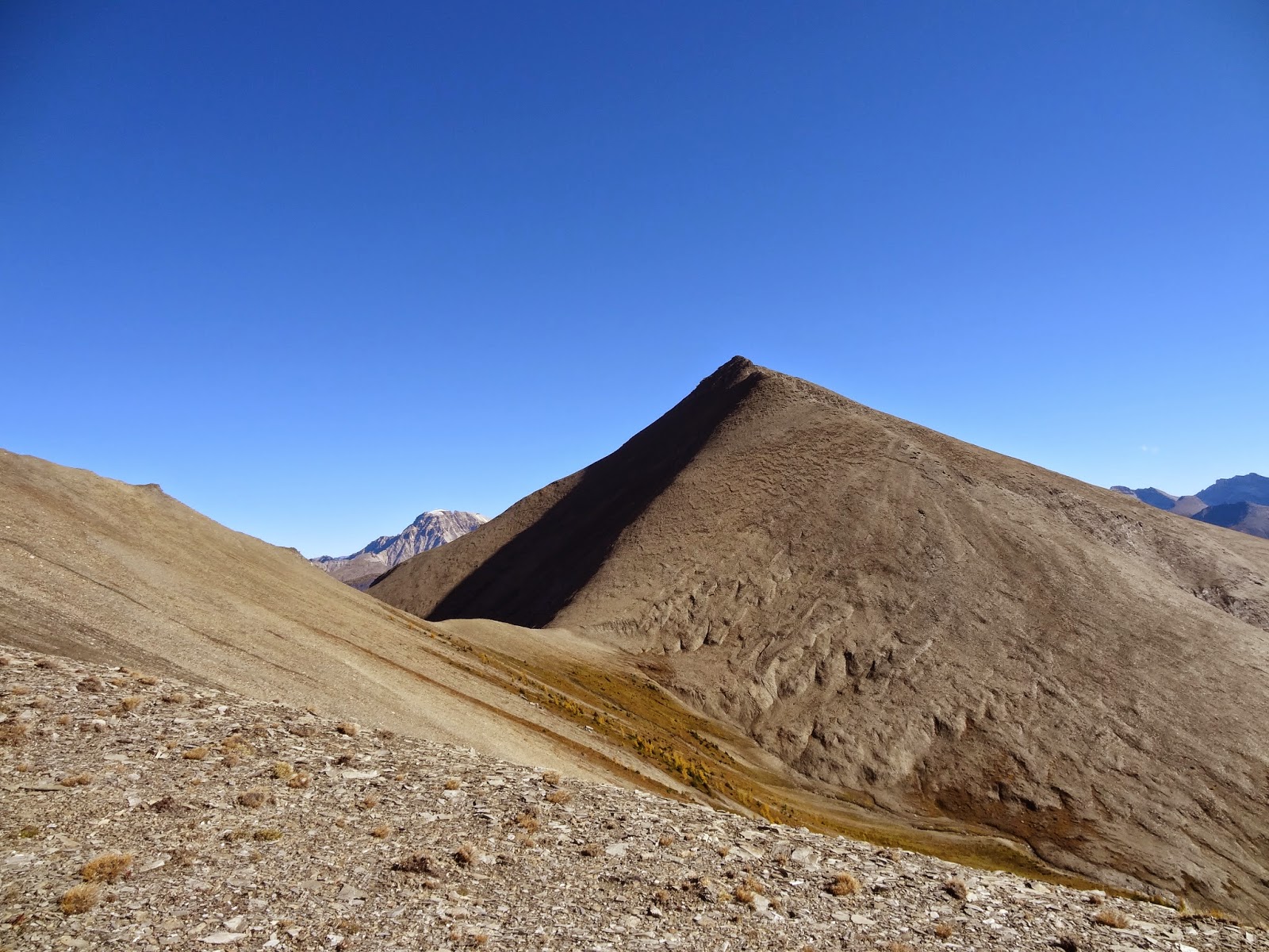


The view back down to the road is of course better from the true summit as it is further east. To get off the false summit there is an exposed step that is getting into more lower moderate terrain than easy. It is really the only place the ascent isn't in the range of easy scrambling though. I think you can go to the south off the ridge crest to get around it a bit. But I really don't like side-hilling and the step didn't seem that bad. Perhaps I am getting better at scrambling since I am not getting scared as much anymore. The rest of the ascent to the true summit was easy, we stayed on the ridge except for a slight detour to the south to avoid a big step you couldn't really scramble.


After taking our time on the summit despite the long way back to camp, then time to pack up, then finally the long way back to the car we still had to complete today, we made our way down.

The ascent up the slope beside Numa Pass was painful, but soon we were on our way back down to the trail. We then hurried down the trail to the camp so we could start packing up. The only thing I would change about this trip would have been spending another night at Floe Lakes so we didn't have to hurry out the same day and walk so far in one day. It would have been nice instead to take a short nap after the ascent, before waking back up to another relaxing evening by the lake.

After packing up, the descent down to the car was a bit of a slog. We made really good time though, only taking 2.5 hours to get back. The ascent of Numa Mountain and back to camp took 4.75 hours. We got back at 6pm. Then we went to Banff for dinner, which was good because there was another traffic jam due to bridge construction between Banff and Canmore, and then after dinner had a short stay at the hot springs. A really great weekend.
awesome info about Floe Lake, thanks :)
ReplyDeleteThanks for the blog entry! You are the only one I have been able to find that started on Numa Pass. I appreciate the detail. Everyone else only describe the route from the parking lot up the drainage. Thanks again!
ReplyDeleteYour welcome!
Delete