Thunder Mountain (2376m) - Crowsnest Pass January 29, 2015
I took the day off work to climb this mountain. On the weekend previous I had driven past it and seen that it looked relatively dry, then when I saw the forecast for snow on the weekend and that the wind would be reasonable during mid-week I requested the time off so I could go get it. I had been thinking about climbing this mountain as a winter ascent since Nugara's 2nd edition came out, and obsessing since the warm weather started.
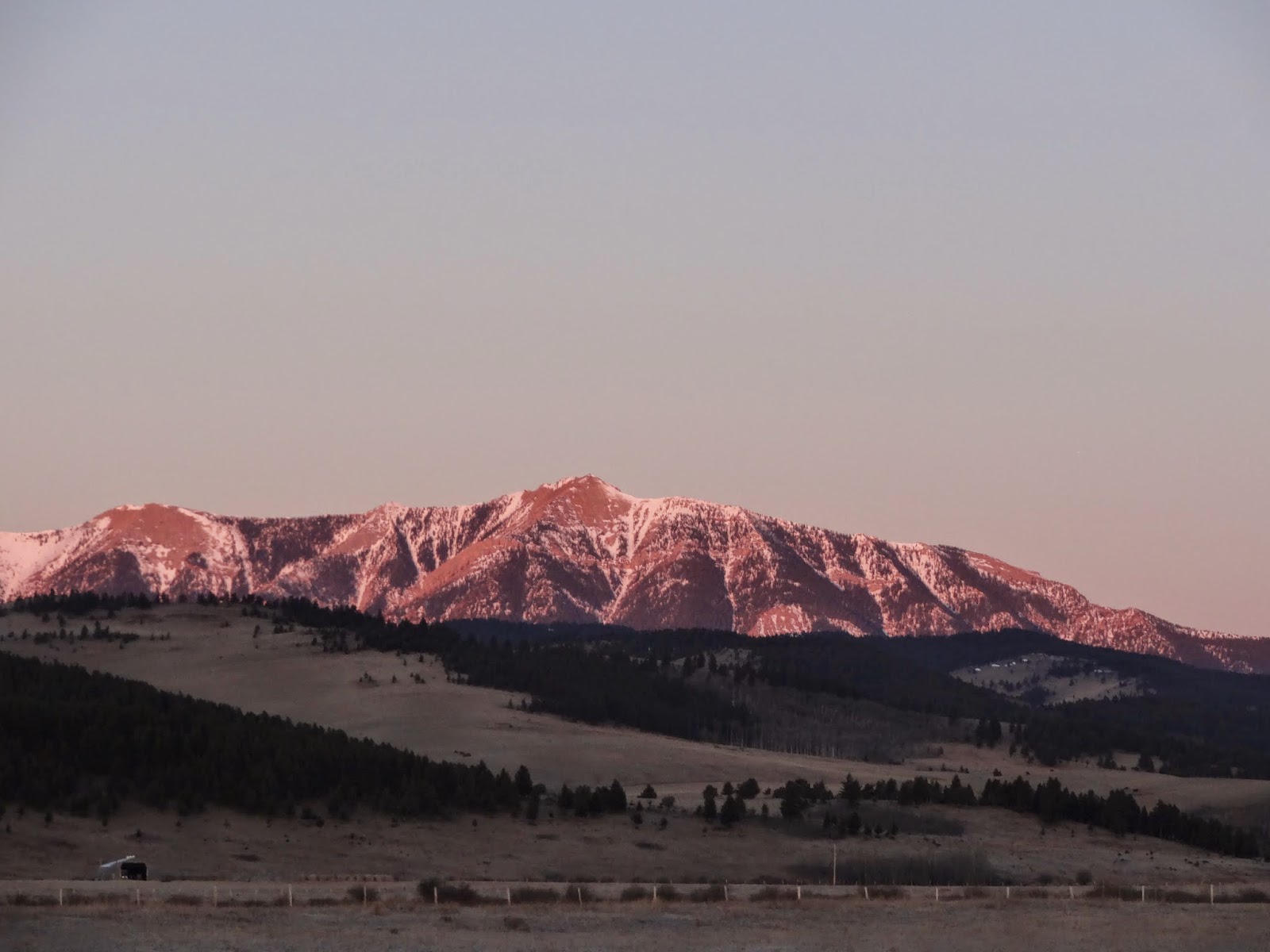
Thunder Mountain from the drive in. I started early to give myself plenty of time to negotiate any tricky areas as carefully as I required.
There isn't much of a trail on this mountain. The macro route finding is easy, just follow the ridge to the summit. The micro route finding is a bit tricky in one or two places. To begin with you must gain the ridge by going up the dirt road tracks and across a flat area to the ridge. Once there you continue along as you will, through a semi-treed area till you get to the first steeper treed slope. In this section you must keep to the climbers left side/rib to avoid cliffs. There is a trail (and some sub-trails) through here, which start on a rocky rib. On descent it can be a bit hard to find and follow the trail, but as long as you are to the right you probably won't have problems.
I took this picture to help me find the trail on the way down. It didn't help... but I found my way down regardless ending up on a sub-trail at one point that led easily down to the main trail near the end.
After that you cross an area with minimal elevation gain and a few large boulders scattered over the end. Then there is the second steeper treed slope, this one had quite a bit of snow cover. I heard there is a trail through it, that starts more or less in the middle. I found some of it on the way down, and it is actually a bit more to climbers right rather than the middle. On that side there was less snow and travel was easier.
View from top of first treed section, only the false summit can be seen so far.
Then the ridge narrows significantly and you continue along it past two outcrops. You can go over both, or to the left of the first, and to the left or right of the second. Due to snow on the east side of the ridge (from the wind) I mainly climbed over both. Neither was very hard scrambling and the dry rock was fun.
View from along the ridge.
View looking back. The snow in places significantly narrowed the available footing on dry ridge, but there was always at least one foot worth of space for every step.
After the second outcrop you are faced with another steeper section.
Next steeper section.
Here in the summer I believe you take a trail off to climbers left that goes back onto the ridge as it widens again. I was worried about having to ascend the snow in the trees as it is quite steep (no photo), however the snow only had a very thin wind crust and was completely faceted underneath. It was relatively easy to kick steps through until I could get back onto dry rock. I went climbers left for a few meters before ascending a few more and traversing back climbers right, for some easy/moderate scrambling till I had ascended up to were the ridge widened again. I was much happier on the dry rock than the snow for sure.
Looking back once I've done a bit of the scrambling on the ridge again.
Done with the narrow section and onto the final slopes to the false summit.
The rest of the ascent to the false summit is a plod up scree/rubble. There is somewhat of a trail here.
Looking back from just before the false summit.
Then you get to the false summit and look at the last bit of ridge to go. All I could think of though was that the weather station wasn't featured in any trip reports that I looked at before leaving. I believe it was built last summer?
View towards true summit from the false summit.
Once again the ridge narrows, sometimes again down to only one foot width of space once the snow on the east side has taken up some of the room. It isn't a problem though, there is only two little steps in the ridge which are both easy to scramble when the main portion of the rock is dry.
View from about half way along the ridge. Its particularly narrow here. Some parts you can keep off the top to climbers right, but mostly it is easiest as Nugara says to stay on the top.
Looking back after the ridge widens again.
Then you are just left with the final ascent of scree/rubble slopes to the true summit. There is a trail leading around the last rock outcrop on the ridge. After following it a bit, I turned back climbers left onto the ridge to avoid snow and followed it to the summit.
Final slopes.
The summit consists of two, almost equally high points. The first with the weather station and the second with the cairn. I didn't bother looking for a register as the wind was kind of bad at this point. I took my photos, ate a bar, and continued down.
View from eastern summit west to the prairies.
View from eastern summit west to the cairned western summit.
View from western summit southwest towards Crowsnest Mountain.
View south.
View north.
View west.
Heading back along the ridge between the true and false summits. This is the most scrambly section along it, though it does get very narrow in other parts.
Looking back as I am about to go back into the snow after descending the ridge below the false summit.
Looking back up at the snow section. It is a bit steeper than it looks.
The sun comes out on the ridge. This is taken from the same point looking forward. I had another break by the second outcrop away from the wind. Nice to have cell phone coverage there and on the summit.
Overall this was a great day and a great scramble. Easy enough to do in winter, enough ridge and a few scrambly sections to keep interest. I really enjoyed it. It would be good in the summer too, but not on a very windy day!
Tent Ridge (2554m) - Kananaskis Country October 18, 2014
Due to snowfall over the past week we went for a slightly easier objective this weekend. Since one member of the group had to back in Calgary early we started just before 8:30am, meaning we had to get up around 5am to get out to the trail head in time. Therefore we didn't get to see much of the conditions driving in to the trail head as it was dark.
We followed the directions in the Kananaskis Country Trail Guide by Gillean Daffern, helped by photos in trip reports. The initial turn off of the logging road is easy to find as it is marked by a cairn where you must turn right, and the way straight ahead is blocked by several fallen trees moved to block it. We didn't see any other junctions, but the trail was under snow. I was in the lead the most of the way and I only lost the trail briefly a couple times while we went around deadfall. Otherwise following the trail was helped by a small animal that had followed it earlier and left little tracks along it. Thank you to that animal as in the open sections it was hard to see the slight change in snow shape that outlined the trail.

After the first few minutes the trail was covered in snow. It was not overly obvious but we managed to follow it into the bowl and up to the ridge. There was a lot of deadfall along the trail and at some points it was quite narrow so that it almost felt like bushwacking when it went between two very close trees.
Getting into the bowl. The start of the ridge is above us. The scrambly section s are on this first part where there appears to be bumps in the ridge.
The bowl in the center of the horseshoe shaped ridge. The true summit of the ridge is to the right. The first highpoint on the ridge is to the left and contains the large weather station. The trail soon turns to the left here and heads into the trees.
Almost out of treeline and onto the ridge proper.
Initially the ridge was just steep snow covered rubble/scree. After which you get up to the scrambly sections.
Looking back.
The scrambly sections looked more intimidating in the fresh snow, which was a little bit slipperly, but not so bad. At this point with the view ahead the other three chose to turn around, leaving three of us to continued on. This meant that it was safer to have Keara off leash so that she didn't pull Heath around. With only one person she didn't know she was fine. In fact she ended up following Carlo most of the way as he was usually in front, and had given her a tiny piece of chicken at one point. To get around the pictured difficulty we dropped down slightly on the right side and then ascended rubble/scree next to the rock until it was easy to get back onto the top of the ridge.
Continuing on. There were several sections of scrambling. The one that turned the others around was the worst, though there were sections that were snowier and more narrow after that.
Looking back. The weather was pretty bleak in the morning except for this rainbow which appeared from time to time in the direction of Spray Lakes, and patches of sun over the road to the southeast.
Looking ahead. One last scramble section to go.
This one we went straight up which involved grabbing bits of rock to hold onto while stepping up steep snow and rock. It wasn't that bad, but personally I think this is exactly the sort of terrain I would have been scared of myself several years ago, so I totally understand why the others turned back. Winter is too long to go to waste though, so I am very glad I got over some of my fear.
As the clouds broke up there was cool lighting over the road to the southeast. Chester Mountain is over on the far left going out of the photo.
Almost at the first high point with the weather station on it. It also had a camera on its post, which we debated whether it was for security or web streaming of weather events. As it wasn't pointed down to the ground it was probably the former.
From the first high point looking over at the true summit of Tent Ridge. The weather was still gloomy at this point, the wind was pretty high and it was blowing snow at us. It was easy to wonder whether the rest of the ascent would be much fun or not at this point. Some food and water helped. Some hot chocolate with Baileys in it from Carlo helped more.
View of the Fist from the first high point.
The sun coming out over the road.
It shines on us briefly and shows off the rainbow again.
The way up to the true summit looked very steep from certain angles around the first high point. However it was actually very easy to ascend as there was a slightly switchbacking trail the whole way up. This is looking back along the route. Tryst Lake is below to the right. Some backcountry skiers go there in the winter to ski the chutes. I am certainly not good enough to ski that kind of terrain yet.
About to reach the summit where Carlo already is, and Keara. As again she abandoned her actual owners/parents to follow a complete stranger simply because he was in front & had chicken.
Summit looking north along the rest of the ridge. There were a few trickier sections right after this summit. They were easy enough though as you just drop down to the left a bit to avoid anything too hard, then traverse back onto the ridge. One even got to involve a short glissade for the boys, which I opted out of. Guess I still have a bit of a ways to go fear-wise compared to some.
View northeast down into the bowl of the horseshoe shaped ridge. At some point it had become almost nice out, or at least the clouds had broken up so the views improved greatly.
View east towards several of Kane's scrambles, from left to right: Mount Engadine, The Tower, Mount Galatea, and Mount Chester. The first high point with the weather station is in front.
View to the southeast. With no chicken forthcoming Keara decided our summit stay should be short and started looking back the way we came and crying. Guess she was a bit cold even with her sweater. I should have brought her X&O coat as well. Too bad for her we are going back a different way today. Thankfully for us it was much easier and even slightly shorter at this point. Time-wise at least.
View to the south. The Fist in front.
The Fist to the left and Mount Smuts to the right.
Looking back at summit after first couple of steps off of it.
Avoiding a bit of a scramble by bypassing it on the left. There was trail to start but eventually we just ended up on snow.
After that section the rest of the ridge was a walk.
Looking back.
Looking northwest. Watridge Lake is visible in the distance.
Looking back again.
Still on easy ridge. I bet this would be a great meander in nice weather. We kept up the pace though because the wind hadn't really died down even after the clouds had cleared up.
Looking back again.
Looking southeast over at the start of the ridge were the scrambly sections were, from the last high point on the ridge before descent.
This ridge does indeed have great views! Mount Engadine and the Tower again.
The Tower, Mount Galatea, and Mount Chester again.
Spray Lakes again. Mount Nestor and Old Goat Mountain behind it to the far right.
Descending down the ridge. Here the route finding got more tricky for us. The directions to follow in the new addition are for ascent. So reading them and then interpreting them back in reverse, took brain power my sleep deprived brain didn't want to give up. We descended quite far down the ridge here, basically to treeline before turning to skiers right and descending down the slope. This was obviously too far to go. If you go here in the summer you should descend earlier to find the actual route. I am sure it is more obvious without snow cover.
Great view of Spray Lake from farther down the ridge.
Looking back up. There was another slightly switchbacking trail here. Not that you really needed it on descent.
Here we are about to turn off and descend the slopes below us. Since we had descended along the ridge so far we ended up going into larch forest. We decided we were too far skiers left and started traversing more skiers right into the open, so we could see where we were headed and hopefully end up in the gulch. We didn't really make it, but we did end up in a gully type thing and kept descending down that as it seemed to almost meet a cut block at the end. The trail went through this cut block, plus it was more open so we could at least see where we were better, so hoped to end up there.
Looking back up at larch forest and steepish snow slopes. It was actually much easier to descend that I would have thought. Thankfully the snow wasn't that soft/melted at this point in the day. Since the snow wasn't very deep and if it had been slushy it would have been very slippery on the grass underneath going down. The gully we followed after this slope, sort of just ended after a while, and then we bushwacked briefly down and skiers right into the cut block. There we started towards the far lower corner as I thought the description said the trail would be there. Instead Heath found it pretty much in the center of this cut block and we happily followed it easily back to the car.
The trail, once found, was very easy to follow through this cut block and along a logging road. It then gained a tiny bit of elevation before entering another cut block and going through it on the left hand side until ending up on another logging road. It then intersected another wider road which was mostly flat. Turning right there we continued on for not very far until it descended slightly back to the road and our cars. This trail on the way down was much nicer than the one on the way up. The route it took being less bushy because it was much wider with almost no deadfall on it.
The whole trip took us 4h 40min. Not too bad with snowy conditions and bushwacking! Maybe we should have stopped for more views but that just isn't always practical in the winter with the cold wind and all. Plus I always feel bad for the dog when we stop. No matter how many coats you put on her, she is always cold at breaks. She needs to eat more and get fatter but I just can't convince her to eat enough dog food for that.