Athabasca Pass - Jasper National Park, AB September 8 - 13, 2015
(Day 5 - September 12 - Kane Meadows Campground to Simon Creek Campground)
We woke up early on this day to get a good head start. I wanted to get as much distance done today on the way out as possible, to shorten the next day we would have to do. As that day we would have to drive back to Calgary as well. We managed to go 26km in 7.5h. It was a long march, and the last 5km between the Warden Cabin and Simon Creek Campground were super painful.
View along the river early in the morning.
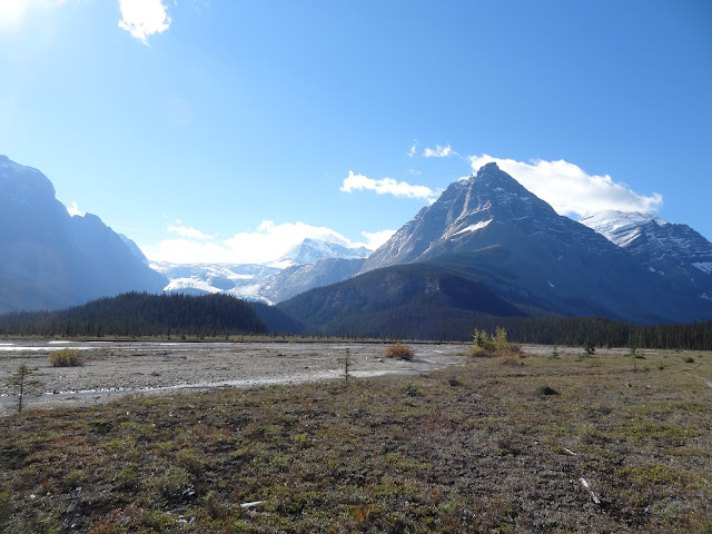
It was sunny early in the day. Which made for good views along Scott Gravel Flats.
Looking at the Scott Glacier.
Farther on.
Close up of the Glacier and Mount Hooker.
At the end of the gravel flats about to go back into the trees.
View of the river.
Flats by Middleforks Campground.
Once past the campground we got to the new course if the Middle Whirlpool River again. The wide part we crossed in the same manner across the log. We saw someone else just walking through the whole thing, jumping from one high piece of vegetation to the next. Then we got to the marrow part. There was a park warden with a chainsaw working on this part. He was building the 'bridge' pictured. He told us to hold onto the stubs of the branches while we crossed. This worked well. When we got to the Warden Cabin we met the other warden. He asked how we got across that part to begin with, and I had to show him the picture to explain how we used the smaller unstable log they had cut away by then. I forgot to ask him if they planned on rebuilding the bridge at Scott Glacier Flats when he mentioned they cut it down last year. I suppose they probably will not.
(Day 6 - September 12 - Kane Meadows Campground to Simon Creek Campground)
Again we woke up early to get a head start. We had to walk 15km to get back to the car. The last 8.6km on the awful fire road again. The last 6.6km of that after Whirlpool Campground where we had our last break were very painful. It was a bit of downhill at first, then a lot of uphill and flat sections. The road just kept going, and going, and the only thing to look at was the old Moab Lake burn forest, besides for occasional views of the top of Mount Edith Cavel. We managed to march the whole 15km with our heavy packs on in only 3.5 hours including breaks.
View of the river near Tie Camp. The mountain in the far middle distance is the one that is right above Scott Campground.
Another view of the river near Tie Camp.
All in all this wasn't the most senic trip I've been on, obviously as it was mostly in the trees. A lot if times the whole point of hiking, and therefore also backpacking, is to be above treeline. On this trip you never do get above treeline on the trail. While there are good views to be had, there is also a lot of forest marching. The wilderness feel of the trail and area is strong, and there is also a lot of history here. It is also good for people who want solitude . While I am glad I have completed it, I would not do it again. Even if they do build a new bridge over to Scott Glacier.
Looking up at Edith Cavel as we hiked out on the fire road made me think that, next year I should do more rock climbing and/or mountaineering. Although I still really want to do the Michelle Lakes / Pinto Lake / Cataract Pass part of the GDT backpacking trail. That sounds scenic. Also on the NCT someone mentioned the Stein Valley Traverse out in BC. That also sounds interesting. As well, I really want to go to Alaska and hike the Chilkoot Trail.
(Day 1 & Day 2)
(Day 3 & Day 4)


No comments:
Post a Comment