
Mount Rowe - Waterton National Park, AB September 19, 2015
The weather forecast wasn't too good for this weekend. Waterton looked like the best bet for not being rained on, and not running into snow at higher elevations. For the snow I found out from simply from looking at the webcam of course. A trip report from just a week and a half earlier showed plenty of snow. The wind was foretasted on mountain forecast to be high-ish, but that is normal for Waterton, so that didn't deter me.
I'd decided on this mountain on Thursday night. It was the best bet in Waterton for an ascent that I hadn't done yet, that included larches along the way. Although I like to make fun of people who go crazy over these trees, I do like to hike through them during this time of year at least once. On Friday I was checking the forums and found out that Matt C. who's webpage I browse for conditions/photos was going to the same area. I figured we'd have to run into each other at some point, but we never did (more on that below in the pictures!).
I set out from Calgary kind of late as I slept in a bit. I didn't start out until 11:15am. I'd stopped in Pincher Creek along the way to get a coffee (why do I do that to myself, it took about an hour for the coffee shakes to wear off), and the wind had been terrible as I went into and out of the Tim Horton's. So I already knew I wasn't in for a pleasant ridgewalk, but after driving all that way it certainly wasn't going to stop me. After 1.5 hours I was up at the lake, and only stopped for a brief break to eat before heading up.
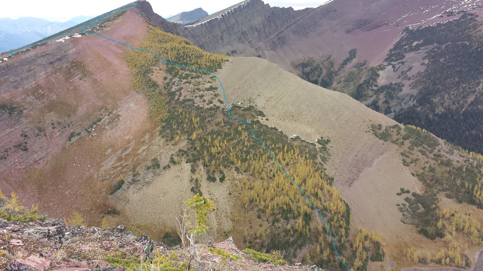
The route I chose is Nugara's descent route. As much as I love scrambling on solid rock these days, I was under-motivated and picked the easiest way up. Also because of the wind, I wouldn't want to scramble moderate in high wind. The descent route ascends easy slopes on the west side of the lake. The entire ascent is then turned into nothing but a hike that anyone could do. I picked a line farther south than most people, so I could stay in tree cover for as long as possible. The wind just around the lake was strong when it gusted, and I wanted to be blown around as little as possible. When I got up above the lake and saw there were more larches you could avoid or walk through, I went straight through them as well for as long as was reasonable.


As I went along this section I saw bear diggings, but I reasoned that they were older for whatever reason. I was dead wrong! When I got back home and was again browsing the forums on Monday, I found out that Matt had gone to Mount Rowe as well after all. We'd just missed each other. He posted that he he saw a bear right were those diggings were when he was on the ridge! So those diggings were far from old, they were as fresh as you can get! I didn't see this bear at all thankfully.
Matt and his wife had been descending more to the north while I was ascending in the trees and that was how we missed each other. Thankfully we didn't corner the bear between us somehow. I was making less noise than I usually do because I figured what self-respecting bear would hang out so close to all those people at the lake? Now that was obviously stupid. Most bears don't care about people at all, especially when they know most don't go off trail, and this one obviously didn't care. I'm glad it heard me to get out of my way. At some point I must have passed quite close to it. It doesn't scare me, so much as made me re-think about my ideas about bears a bit.


After I got onto the ridge; and although I knew the summit was to the east, I kept looking over to the west at another high-point. This ridge runs all the way along to Festuburt in the far distance. I decided the high-point couldn't be that far, and I might as well go over there and see the view from it at the beginning. If I did Rowe first, I probably wouldn't have the motivation to go afterwards. So I went west instead of east, and the wind was bad. Terrible when it gusted, which was a lot. It was also a lot farther to the high-point than I expected at first from the view where I got onto the ridge (it always is!). The view from the top was ok, but I didn't even bother to take my pack off before heading back. I didn't want to stay on the ridge for longer than necessary.


This picture was a mistake to make standing up! I had taken my camera along, but it was doing the annoying thing it does sometimes where even if you charge it, it refuses to turn on after one night sitting in your pack. So I was taking all these pictures on my phone. It is actually quite hard to hold your phone steady, and with a good grip, when the wind is blowing at you. Then just after I took this photo it gusted really badly. I'd already turned west again, so the wind was on my right side threatening to blow me over the cliff. I have no idea why I was standing to take this picture, but I was. I panicked as my footing wasn't great, as I'd been in mid-turn when the wind gusted. I felt like I was going to fall over the cliff edge. So my subconscious did the thing it felt was most reasonable at the time.... it made me jump to my right, towards the wind and away from the cliff. Mid-jump my right leg started cramping so I was too distracted to fall properly, and landed on my right thigh and wrist, cutting both of them up on rocks. Thankfully the leg cramp stopped after half a minute and I could think again. I felt really silly lying there on the ridge. Even more so when I saw that my phone was recording the whole thing as a video because somehow I'd hit video mode as I fell.
After dusting myself off and checking out my wrist, which thankfully wasn't bleeding enough for the first aid kit, I continued along to the summit staying far away from the edge. I crawled up to the edge for the rest of the photos of the lake from the ridge.


It was a good day despite the wind and the lack of sunshine. Any day in the mountains is better than a day at home.
No comments:
Post a Comment